
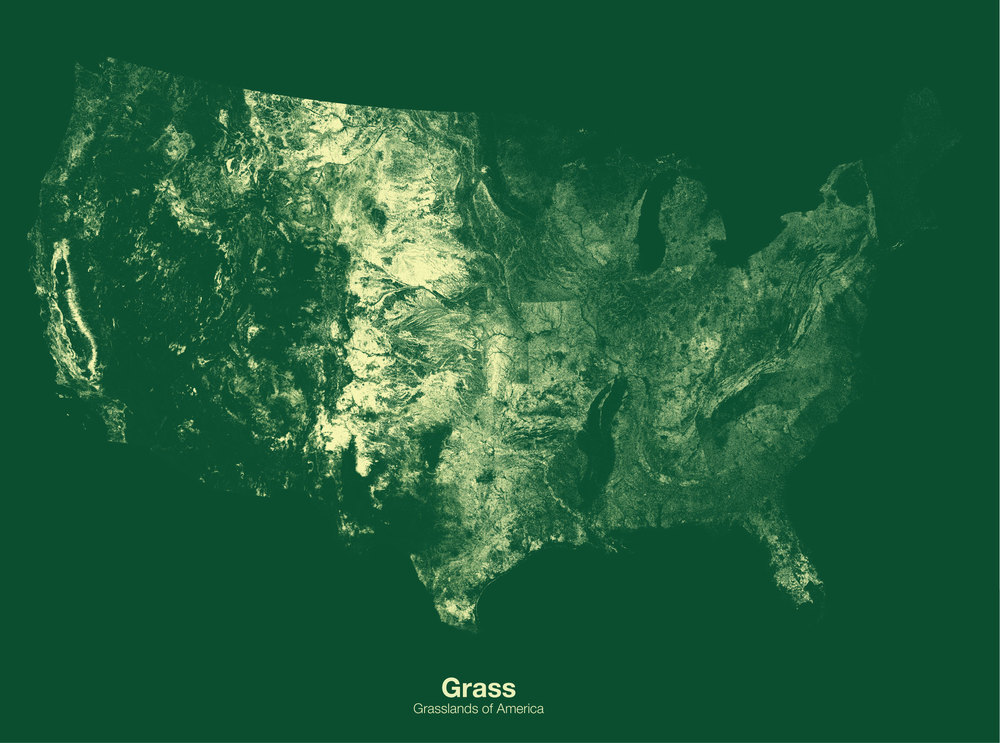

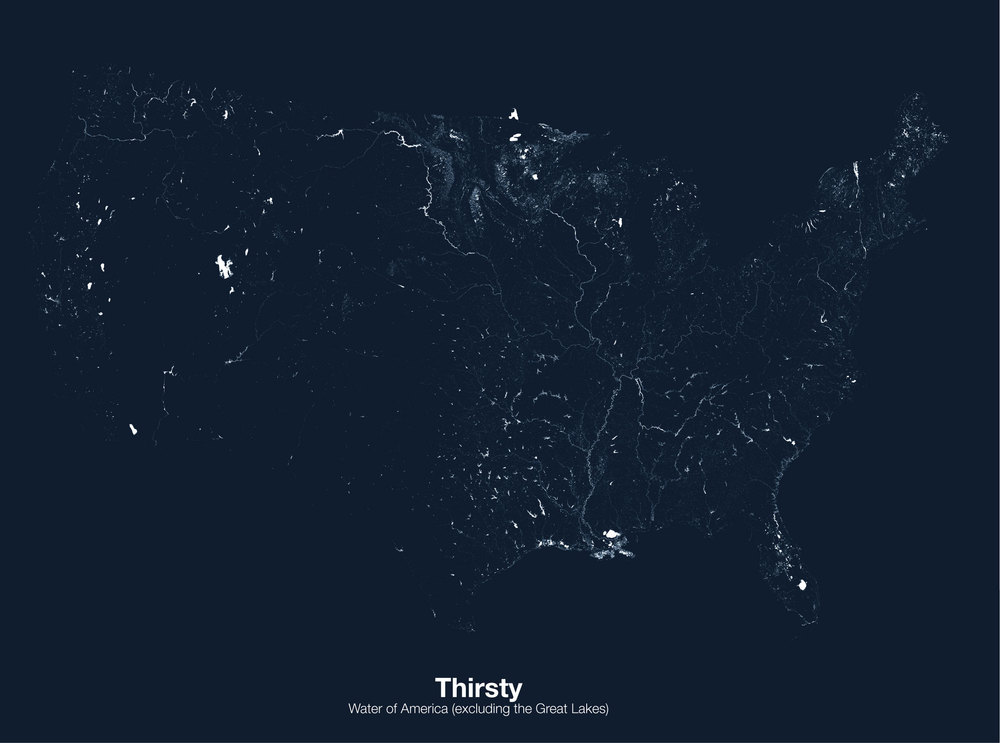


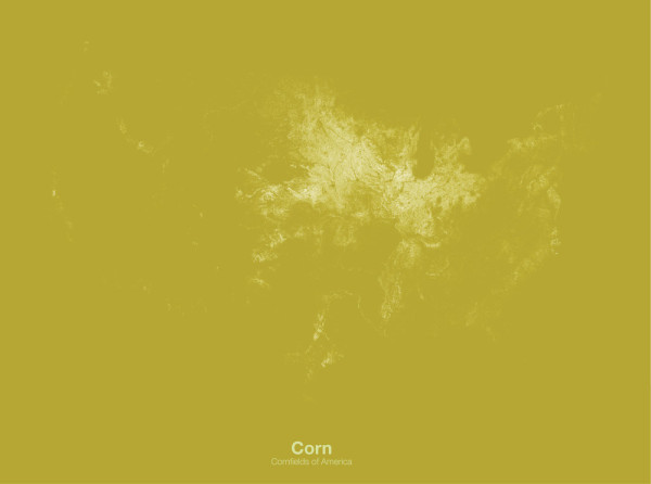
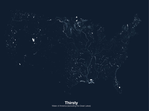
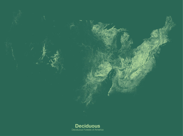
It’s not everyday I mention the USDA when it comes to graphic design, but Michael Pecirno’s series of United States maps colored in using figures extrapolated from data gathered by the USDA’s CropScape Program superimposed over satellite photography does surprisingly make for striking representations of otherwise mundane annual agricultural figures.
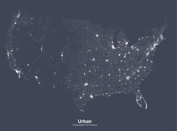
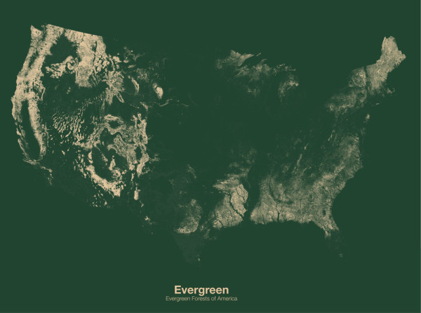
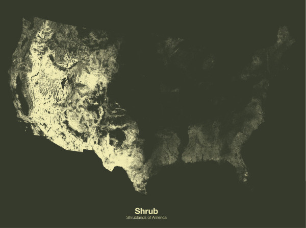
Well, let me clarify—I actually find data related to deciduous or evergreen forest growth, grasslands, or corn crop acreage actually quite fascinating in itself. But as pictured onto a map, those figures become more concrete, these visualizations communicating a specific data set of the American landscape.
“…corn fields take up 91 million acres of the American landscape. This is a staggering 4.83% of the continuous United States. While hearing that value is quite astounding, there is little way right now for us to visualise what 4.83% of the American landscape looks like, or furthermore, where this land is.”
Minimal Maps by Michael Pecirno are available as 12″x16″ or 18″x 24″ prints, but we also think they work well as desktop wallpaper for mobile devices, worthy of inclusion amongst Design Milk’s own Designer Desktop for smaller display.